Fruitland Downtown Master Plan
Improvements

Prepared for The City of Fruitland
Prepared by PlanMakers


report problem

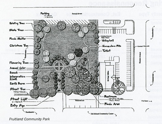
Fruitland Community Park
(Page 18)
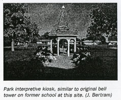
Located in the center of the downtown, the Fruitland Community Park provides recreation, a children's playground, picnic tables, picnic shelter, city history, map and information signage under a bell tower, rest rooms, phone, drinking fountain and well-maintained green spaces. The park would continue as a prime place for children's play, conversation and relaxation for weary shoppers, downtown workers and visitors. A number of outdoor and civic events would be coordinated with business district promotions.

Likewise, the Old School Community Center would extend events into the park.


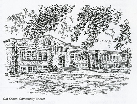
Old School Community Center
(Page 18)
Centrally located in the downtown, the old school provides a multi-purpose space that creates life and activity for the city center. The handsome 1928 brick school with a 1939 addition features a restored auditorium, gymnasium and numerous classrooms. The new Fruitland Library is located in the center. Other space is available for rent or for future expansion. The center is operated by Alma Mater Inc., a 501(c)(3) non profit, tax deductible foundation working to save the Old Fruitland High School for future uses. Thanks to volunteer help and contributions, the building is being rehabilitated to support community activities. The auditorium is undergoing restoration to the floors, seating, windows, balcony and stage area. A new 8-foot extension of the stage provides more usefulness. The facility is available for plays, presentations, concerts, speeches, community forums and special events.

report problem

Zeller's Crossing Monument
(Page 19)
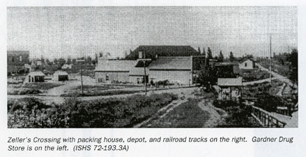
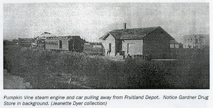
The area around Pennsylvania Avenue and the railroad tracks was known as Zeller's Crossing. Freight was unloaded and the first packing shed was built near the former depot, located along the tracks between 2nd and 3rd streets. A number of packing sheds were built nearby. Other than the tracks, little remains of the crossing. A Zeller's Crossing interpretive sign is to be installed at Pennsylvania and Main, commemorating the founding of the city, the railroad and the depot. The setting allows excellent views of the tracks, Farmers Cooperative Canal, and down Main Street or Pennsylvania Avenue.

report problem


Idaho Northern and Pacific Railroad
(Page 19)
Headquartered in Emmett, the railroad operates the branch line between Payette, Fruitland, New Plymouth and Emmett. The tracks run along the eastern edge of the downtown. Currently, one round-trip freight train travels the line each day. It is recommended that the area along Pennsylvania Avenue and the railroad right-of-way be graded and upgraded for railroad freight and passenger use. An improved site will better serve the Santa Claus Express Train which delivers Santa to Fruitland during the Christmas holiday. A Zeller's Crossing interpretive sign will help commemorate the railroad's arrival.


Farmers Cooperative Canal
(Page 19)
A prominent manmade feature of Fruitland is the Farmers Cooperative Canal. The irrigation canal was constructed in 1892-93 and provides water from the Payette River. The canal travels through the east side of Fruitland and serves as the eastern boundary of the downtown. The canal corridor creates an attractive asset to the city and the adjacent ditch rider road provides an opportunity for a walking and bicycling path. Pedestrian-bicycle paths connecting the downtown and nearby neighborhoods will benefit the city center.

report problem

Downtown Housing
(Page 19)
Housing in and near the downtown can positively influence the overall appearance and strength of the city center. Downtown residents become a built-in commercial market and provide new life and security to the city center. Downtown housing for the elderly is also recommended since living downtown is often convenient, providing easy access to shopping, restaurants and entertainment. Emphasis should be given to encouraging new housing in and adjacent to the downtown. The housing stock within and around the downtown should be rehabilitated and underutilized sites should be reused.

Other housing opportunities exist for adaptive use of upper floors of existing buildings for residential housing. These spaces would make excellent studio apartments for the merchant to live above the store. To accommodate such use, the city needs to update its current ordinances to encourage and allow residential use in the downtown. These projects reinforce Fruitland's goal to maintain and improve the quality of housing and residential development in the city.

report problem

Pennsylvania Avenue Entryway Beautification
(Page 20)
Fruitland's South Pennsylvania Avenue entrance into the downtown is to be upgraded with trees, sidewalks and bike lanes. The street will take on the appearance of a county lane, a slow moving, tree-lined street serving cars, cyclists and pedestrians.

South Pennsylvania Avenue provides characteristics of rural life worth preserving and enhancing. Leaving U.S 95, drivers experience a number of historic homes and simple outbuildings along side irrigated fields yielding bountiful crops. The semi-rural corridor extends past the Fruitland Middle School and through a neighborhood of homes facing the avenue and into the curve entering Main Street.

Currently, the avenue is two lanes with a turning lane section serving the Fruitland Middle School, and without sidewalks or curb and gutter. The avenue has storm drains, but they do.not currently drain. Fourth Street to 6th Street through the Poma Terra and East Fruitland additions has a 55-foot right-of-way. 6th Street to U.S. 95 has a 60-foot right-of way. The speed limit is posted as 35 mph.

An architectural reconnaissance prepared in 1999 by SAIC found eight historic buildings along Pennsylvania Avenue. Examples include the a farmstead (7100 Pennsylvania), a Victorian house and barn (7125 Pennsylvania), a board and batten barn and a handsome two-story residence (7180 Pennsylvania).


Triangle Entry Park
(Page 21)
The small triangular site located at the intersection of U.S. 95 and South Pennsylvania Avenue is proposed for a landscaped city entry park. The site is to be purchased and improved, with an entrance off of Pennsylvania Avenue for a two-car parking and small picnic area. The park would be landscaped and a Welcome to Fruitland sign installed. Another option is to create additional parking for a Park and Ride commuter lot.


Pennsylvania Avenue Bike Lane
(Page 21)
A key component of the avenue is two striped 6-foot bike lanes. Vehicle and bicycle safety conflicts will be reduced by striping the roadway. The bike lanes would connect to a 10-foot asphalt bicycle/pedestrian path located along U.S 95 beginning at milepost 61.1 north of the 1-84 overpass and ending at the junction of Highway 30/95 at NW 16th Street at milepost 64-9. The bike lanes would connect to the Fruitland Middle School and extend via a tree-lined and fenced path to the Fruitland High School and Grade School. On the north the lanes would connect with a bike route on SW 4* Street and to the proposed Farmers Cooperative Canal pathway and Main Street. The bike system would provide a link to the Old School Community Center, the Fruitland Community Park and the U.S. 95 underpass, which leads to Crestview Park.


Pennsylvania Avenue Improvements
(Page 21)
Proposed improvements as illustrated include two travel lanes, two bike lanes, curb and gutter, planting strips, sidewalks, welcome sign and lighting. A special pedestrian crossing is proposed just north of the Fruitland Middle School connecting to the high school and grade school. Light strips along the crosswalk would blink when activated by pedestrians. This project will create a safe, healthy, and scenic alternate form of transportation for many people living in Fruitland's community as well as for visitors passing through.


Tourism Development
(Page 22)
Fruitland has the opportunity to expand its visitor and tourism economy. The Fruitland Chamber of Commerce will maintain an office at the recently expanded City Hall. Located adjacent to U.S. 95, the office is a good location for providing local information. Local sites include the Payette River, Snake River, Four Rivers Cultural Center, Old School Community Center, Fruitland Community Park and downtown historic sites. Potential partners include the Southwestern Idaho Tourism Association, a regional organization involved in planning and implementing marketing efforts for the region and the Idaho Division of Tourism.


These electronic pages are intended for personal research and may not be reproduced or distributed in any format without the knowledge and written permission of the submitter. Selling or using this information in a commercial venture is strictly prohibited. Any other use, including copying files to other sites, requires permission from the contributors prior to uploading. This page is offered as a courtesy. The USGenWeb Project makes no claims to the validity of the information submitted and believes that each new piece of information should be researched and proved or disproved according to the weight of evidence.


Return to Payette County IDGenWeb Home