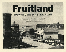
| Cover | Cover |
| Table of Contents | Inside Cover |
| Aerial View | 2 |
| Acknowledgments | 3 |
| Introduction | 3 |
| Setting | 3 |
| Study Area | 3 |
| Downtown Potential | 3 |
| History | 3 |
| Zeller's Crossing | 3 |
| Early Businesses | 3 |
| State Highway | 5 |
| School and Church | 6 |
| Growing and Shipping Fruit | 7 |
| Village Incorporation | 7 |
| Downtown Master Plan | 8 |
| The Revitalization Plan | 9 |
| Main Street Name | 9 |
| Streetscape Improvements | 9 |
| Streetscape Prototype | 11 |
| Main Street Streetscape Prototype | 11 |
| Iowa Avenue and Main Street Intersection | 11 |
| Kansas Avenue and Main Street Intersection | 12 |
| Lighting | 12 |
| Trees | 12 |
| Plantings | 12 |
| Street Furniture | 13 |
| Street Benches | 13 |
| Bicycle Parking | 13 |
| Trash Receptacles | 13 |
| Drinking Fountains | 13 |
| Banenr Wire | 13 |
| Interpretive Signs | 13 |
| Street Furniture | 13 |
| Utility and Street Improvements | 13 |
| Parking | 13 - 14 |
| Building Rehabilitation | 15 |
| Building Inventory | 17 |
| Entryways | 16 |
| City Entrance Signs | 16 |
| Highway Guide Signs | 16 |
| Welcome Signs | 16 |
| Business Signs | 16 |
| Fruitland Community Park | 18 |
| Old School Community Center | 18 |
| Zellers Crossing Monument | 19 |
| Idaho Northern and Pacific Railroad | 19 |
| Farmers Cooperative Canal | 19 |
| Downtown Housing | 19 |
| Pennsylvania Avenue Entryway Beautification | 20 |
| Triagle Entry Park | 21 |
| Pennsylvania Avenue Bike Lane | 21 |
| Pennsylvania Avenue Improvements | 21 |
| Tourism Development | 22 |
| Economic Development Marketing | 22 |
| Funding | 22 |
| Implementation | 23 |
| Appendix | 24 |
| Village Map 1955 | 25 |
| Map | 26 |
| Map | 27 |
| Labels | 28 |
| Bibliography | 29 |